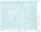
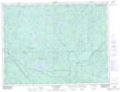
Maps showing Lac Onglet, Lac-Ashuapmushuan; Le Domaine-du-Roy, Quebec
Lac Onglet is a Lake located in Lac-Ashuapmushuan; Le Domaine-du-Roy, Quebec.
- Latitude: 49° 21' 43'' North (decimal: 49.3619444)
- Longitude: 73° 59' 51'' West (decimal: -73.9975)
- Topography Feature Category: Lake
- Geographical Feature: Lac
- Canadian Province/Territory: Quebec
- Location: Lac-Ashuapmushuan; Le Domaine-du-Roy
- GPS Coordinate Locator Map: Lac Onglet Lat/Long
Lac Onglet NTS Map Sheets