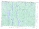
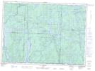
Maps showing Baie de l'Orignal, Rivière-Kipawa; Témiscamingue, Quebec
Baie de l'Orignal is a Bay located in Rivière-Kipawa; Témiscamingue, Quebec and has an elevation of 360 meters.
- Latitude: 47° 1' 3'' North (decimal: 47.0174999)
- Longitude: 77° 51' 10'' West (decimal: -77.8527777)
- Topography Feature Category: Bay
- Geographical Feature: Baie
- Canadian Province/Territory: Quebec
- Elevation: 360 meters
- Location: Rivière-Kipawa; Témiscamingue
- Atlas of Canada Locator Map: Baie de l'Orignal
- GPS Coordinate Locator Map: Baie de l'Orignal Lat/Long
Baie de l'Orignal NTS Map Sheets