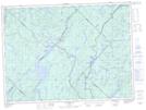
Maps showing Étang Otter, La Tuque; Le Haut-Saint-Maurice, Quebec
Étang Otter is a Lake located in La Tuque; Le Haut-Saint-Maurice, Quebec.
- Latitude: 47° 39' 43'' North (decimal: 47.6619444)
- Longitude: 72° 17' 32'' West (decimal: -72.2922222)
- Topography Feature Category: Lake
- Geographical Feature: Étang
- Canadian Province/Territory: Quebec
- Location: La Tuque; Le Haut-Saint-Maurice
- GPS Coordinate Locator Map: Étang Otter Lat/Long
Étang Otter NTS Map Sheets