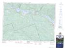
Maps showing Rivière à l'Ours, Les Lacs-du-Témiscamingue; Témiscamingue, Quebec
Rivière à l'Ours is a River located in Les Lacs-du-Témiscamingue; Témiscamingue, Quebec and has an elevation of 377 meters.
- Latitude: 46° 14' 31'' North (decimal: 46.2420043)
- Longitude: 77° 57' 44'' West (decimal: -77.9622602)
- Topography Feature Category: River
- Geographical Feature: Rivière
- Canadian Province/Territory: Quebec
- Elevation: 377 meters
- Location: Les Lacs-du-Témiscamingue; Témiscamingue
- Atlas of Canada Locator Map: Rivière à l'Ours
- GPS Coordinate Locator Map: Rivière à l'Ours Lat/Long
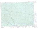
Rivière à l'Ours NTS Map Sheets