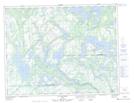
Maps showing Lac des Outardes, Côte-Nord-du-Golfe-du-Saint-Laurent; Basse-Côte-Nord, Quebec
Lac des Outardes is a Lake located in Côte-Nord-du-Golfe-du-Saint-Laurent; Basse-Côte-Nord, Quebec and has an elevation of 33 meters.
- Latitude: 50° 19' 43'' North (decimal: 50.3286797)
- Longitude: 61° 7' 4'' West (decimal: -61.1178413)
- Topography Feature Category: Lake
- Geographical Feature: Lac
- Canadian Province/Territory: Quebec
- Elevation: 33 meters
- Location: Côte-Nord-du-Golfe-du-Saint-Laurent; Basse-Côte-Nord
- Atlas of Canada Locator Map: Lac des Outardes
- GPS Coordinate Locator Map: Lac des Outardes Lat/Long
Lac des Outardes NTS Map Sheets