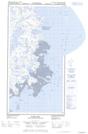
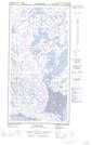
Maps showing Cap Pamiallualuk, Rivière-Koksoak; Kativik, Quebec
Cap Pamiallualuk is a Cape located in Rivière-Koksoak; Kativik, Quebec.
- Latitude: 60° 13' 26'' North (decimal: 60.2238174)
- Longitude: 69° 35' 17'' West (decimal: -69.5880807)
- Topography Feature Category: Cape
- Geographical Feature: Cap
- Canadian Province/Territory: Quebec
- Location: Rivière-Koksoak; Kativik
- Atlas of Canada Locator Map: Cap Pamiallualuk
- GPS Coordinate Locator Map: Cap Pamiallualuk Lat/Long
Cap Pamiallualuk NTS Map Sheets