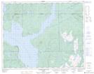
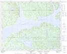
Maps showing Lac Pappour, Rivière-Mouchalagane; Caniapiscau, Quebec
Lac Pappour is a Lake located in Rivière-Mouchalagane; Caniapiscau, Quebec and has an elevation of 380 meters.
- Latitude: 51° 40' 58'' North (decimal: 51.6827778)
- Longitude: 68° 29' 22'' West (decimal: -68.4894444)
- Topography Feature Category: Lake
- Geographical Feature: Lac
- Canadian Province/Territory: Quebec
- Elevation: 380 meters
- Location: Rivière-Mouchalagane; Caniapiscau
- Atlas of Canada Locator Map: Lac Pappour
- GPS Coordinate Locator Map: Lac Pappour Lat/Long
Lac Pappour NTS Map Sheets