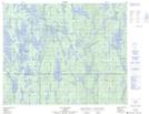
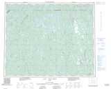
Maps showing Lac Pas d'Eau, Rivière-Mouchalagane; Caniapiscau, Quebec
Lac Pas d'Eau is a Lake located in Rivière-Mouchalagane; Caniapiscau, Quebec and has an elevation of 635 meters.
- Latitude: 52° 39' 7'' North (decimal: 52.6519444)
- Longitude: 68° 51' 55'' West (decimal: -68.8652777)
- Topography Feature Category: Lake
- Geographical Feature: Lac
- Canadian Province/Territory: Quebec
- Elevation: 635 meters
- Location: Rivière-Mouchalagane; Caniapiscau
- Atlas of Canada Locator Map: Lac Pas d'Eau
- GPS Coordinate Locator Map: Lac Pas d'Eau Lat/Long
Lac Pas d'Eau NTS Map Sheets