Maps showing Pointe Pashashibou, Aguanish; Minganie, Quebec
Pointe Pashashibou is a Cape located in Aguanish; Minganie, Quebec and has an elevation of 33 meters.
- Latitude: 50° 15' 12'' North (decimal: 50.2534052)
- Longitude: 62° 18' 25'' West (decimal: -62.3070498)
- Topography Feature Category: Cape
- Geographical Feature: Pointe
- Canadian Province/Territory: Quebec
- Elevation: 33 meters
- Location: Aguanish; Minganie
- Atlas of Canada Locator Map: Pointe Pashashibou
- GPS Coordinate Locator Map: Pointe Pashashibou Lat/Long
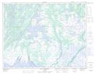
Pointe Pashashibou NTS Map Sheets