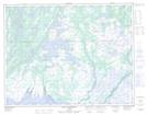
Maps showing Rivière Pashashibou, Aguanish; Minganie, Quebec
Rivière Pashashibou is a River located in Aguanish; Minganie, Quebec and has an elevation of 60 meters.
- Latitude: 50° 16' 39'' North (decimal: 50.2775713)
- Longitude: 62° 20' 52'' West (decimal: -62.3478843)
- Topography Feature Category: River
- Geographical Feature: Rivière
- Canadian Province/Territory: Quebec
- Elevation: 60 meters
- Location: Aguanish; Minganie
- Atlas of Canada Locator Map: Rivière Pashashibou
- GPS Coordinate Locator Map: Rivière Pashashibou Lat/Long
Rivière Pashashibou NTS Map Sheets