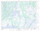
Maps showing Lac Pastour, Aguanish; Minganie, Quebec
Lac Pastour is a Lake located in Aguanish; Minganie, Quebec and has an elevation of 64 meters.
- Latitude: 50° 22' 1'' North (decimal: 50.3670121)
- Longitude: 62° 14' 28'' West (decimal: -62.2412157)
- Topography Feature Category: Lake
- Geographical Feature: Lac
- Canadian Province/Territory: Quebec
- Elevation: 64 meters
- Location: Aguanish; Minganie
- Atlas of Canada Locator Map: Lac Pastour
- GPS Coordinate Locator Map: Lac Pastour Lat/Long
Lac Pastour NTS Map Sheets