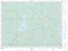
Maps showing Lac Pat, Baie-Obaoca; Matawinie, Quebec
Lac Pat is a Lake located in Baie-Obaoca; Matawinie, Quebec and has an elevation of 517 meters.
- Latitude: 47° 45' 14'' North (decimal: 47.7538889)
- Longitude: 74° 48' 46'' West (decimal: -74.8127778)
- Topography Feature Category: Lake
- Geographical Feature: Lac
- Canadian Province/Territory: Quebec
- Elevation: 517 meters
- Location: Baie-Obaoca; Matawinie
- Atlas of Canada Locator Map: Lac Pat
- GPS Coordinate Locator Map: Lac Pat Lat/Long