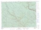
Maps showing Rivière Patapédia, Ruisseau-Ferguson; Avignon, Quebec
Rivière Patapédia is a River located in Ruisseau-Ferguson; Avignon, Quebec and has an elevation of 201 meters.
- Latitude: 47° 50' 39'' North (decimal: 47.8442174)
- Longitude: 67° 22' 32'' West (decimal: -67.3755444)
- Topography Feature Category: River
- Geographical Feature: Rivière
- Canadian Province/Territory: Quebec
- Elevation: 201 meters
- Location: Ruisseau-Ferguson; Avignon
- Atlas of Canada Locator Map: Rivière Patapédia
- GPS Coordinate Locator Map: Rivière Patapédia Lat/Long
Rivière Patapédia NTS Map Sheets