Canada Topographic Maps

Rivière Patapédia Ouest Topo Maps

Topography maps and Latitude/Longitude Location

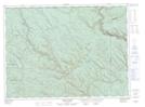
Maps showing Rivière Patapédia Ouest, Ruisseau-Ferguson; Avignon, Quebec

Rivière Patapédia Ouest is a River located in Ruisseau-Ferguson; Avignon, Quebec.

  • Latitude: 48° 4' 40'' North   (decimal: 48.0778263)
  • Longitude: 67° 38' 5'' West   (decimal: -67.6347184)
  • Topography Feature Category: River
  • Geographical Feature: Segment de rivière
  • Canadian Province/Territory: Quebec
  • Location: Ruisseau-Ferguson; Avignon
  • GPS Coordinate Locator Map: Rivière Patapédia Ouest Lat/Long

Rivière Patapédia Ouest NTS Map Sheets

021O13 States Brook Topographic Map at 1:50,000 scale

021O14 Menneval Topographic Map at 1:50,000 scale

022B04 Lac Des Chasseurs Topographic Map at 1:50,000 scale

021B Eastport Topographic Map at 1:250,000 scale

021O Campbellton Topographic Map at 1:250,000 scale

022B Matane Topographic Map at 1:250,000 scale

 
Buy Topographic Maps DVD
Newsletter Sign-up

Yes, I want to receive map store discounts.


Bookmark and Share