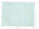
Maps showing Rapides Patten, Lac-Nilgaut; Pontiac, Quebec
Rapides Patten is a Rapids located in Lac-Nilgaut; Pontiac, Quebec.
- Latitude: 46° 3' 48'' North (decimal: 46.0633333)
- Longitude: 76° 32' 55'' West (decimal: -76.5486111)
- Topography Feature Category: Rapids
- Geographical Feature: Rapides
- Canadian Province/Territory: Quebec
- Location: Lac-Nilgaut; Pontiac
- Atlas of Canada Locator Map: Rapides Patten
- GPS Coordinate Locator Map: Rapides Patten Lat/Long
Rapides Patten NTS Map Sheets