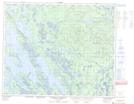
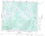
Maps showing Rivière aux Pêcheurs, Lac-Jérôme; Minganie, Quebec
Rivière aux Pêcheurs is a River located in Lac-Jérôme; Minganie, Quebec and has an elevation of 521 meters.
- Latitude: 52° 33' 42'' North (decimal: 52.5616667)
- Longitude: 64° 2' 44'' West (decimal: -64.0455556)
- Topography Feature Category: River
- Geographical Feature: Rivière
- Canadian Province/Territory: Quebec
- Elevation: 521 meters
- Location: Lac-Jérôme; Minganie
- Atlas of Canada Locator Map: Rivière aux Pêcheurs
- GPS Coordinate Locator Map: Rivière aux Pêcheurs Lat/Long
Rivière aux Pêcheurs NTS Map Sheets