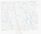
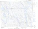
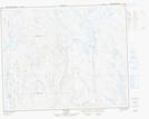
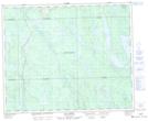
Maps showing Rivière aux Pékans, Rivière-Mouchalagane; Caniapiscau, Quebec
Rivière aux Pékans is a River located in Rivière-Mouchalagane; Caniapiscau, Quebec and has an elevation of 541 meters.
- Latitude: 52° 12' 23'' North (decimal: 52.2064601)
- Longitude: 66° 48' 36'' West (decimal: -66.8099395)
- Topography Feature Category: River
- Geographical Feature: Rivière
- Canadian Province/Territory: Quebec
- Elevation: 541 meters
- Location: Rivière-Mouchalagane; Caniapiscau
- Atlas of Canada Locator Map: Rivière aux Pékans
- GPS Coordinate Locator Map: Rivière aux Pékans Lat/Long
Rivière aux Pékans NTS Map Sheets