Canada Topographic Maps

Rivière Pentecôte Topo Maps

Topography maps and Latitude/Longitude Location

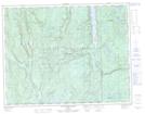
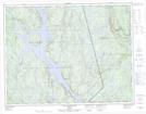
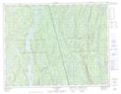
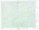
Maps showing Rivière Pentecôte, Port-Cartier; Sept-Rivières, Quebec

Rivière Pentecôte is a River located in Port-Cartier; Sept-Rivières, Quebec and has an elevation of 121 meters.

  • Latitude: 49° 46' 48'' North   (decimal: 49.7800462)
  • Longitude: 67° 9' 50'' West   (decimal: -67.1638564)
  • Topography Feature Category: River
  • Geographical Feature: Rivière
  • Canadian Province/Territory: Quebec
  • Elevation: 121 meters
  • Location: Port-Cartier; Sept-Rivières
  • Atlas of Canada Locator Map: Rivière Pentecôte
  • GPS Coordinate Locator Map: Rivière Pentecôte Lat/Long

Rivière Pentecôte NTS Map Sheets

022G14 Riviere-Pentecote Topographic Map at 1:50,000 scale

022J03 Lac Quatre Lieues Topographic Map at 1:50,000 scale

022J04 Lac Sainte-Anne Topographic Map at 1:50,000 scale

022J05 Lac Beaudin Topographic Map at 1:50,000 scale

022J12 Lac Bouffard Topographic Map at 1:50,000 scale

022G Cap-Chat Topographic Map at 1:250,000 scale

022J Sept-Iles Topographic Map at 1:250,000 scale

 
Buy Topographic Maps DVD
Newsletter Sign-up

Yes, I want to receive map store discounts.


Bookmark and Share