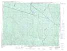
Maps showing Lac des Perches, Saguenay; Saguenay, Quebec
Lac des Perches is a Lake located in Saguenay; Saguenay, Quebec and has an elevation of 364 meters.
- Latitude: 48° 12' 16'' North (decimal: 48.2044444)
- Longitude: 71° 9' 56'' West (decimal: -71.1655556)
- Topography Feature Category: Lake
- Geographical Feature: Lac
- Canadian Province/Territory: Quebec
- Elevation: 364 meters
- Location: Saguenay; Saguenay
- Atlas of Canada Locator Map: Lac des Perches
- GPS Coordinate Locator Map: Lac des Perches Lat/Long
Lac des Perches NTS Map Sheets