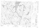
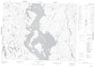
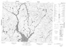
Maps showing Lac Péribonka, Mont-Valin; Le Fjord-du-Saguenay, Quebec
Lac Péribonka is a Lake located in Mont-Valin; Le Fjord-du-Saguenay, Quebec and has an elevation of 431 meters.
- Latitude: 50° 6' 56'' North (decimal: 50.1155556)
- Longitude: 71° 14' 57'' West (decimal: -71.2491667)
- Topography Feature Category: Lake
- Geographical Feature: Lac
- Canadian Province/Territory: Quebec
- Elevation: 431 meters
- Location: Mont-Valin; Le Fjord-du-Saguenay
- Atlas of Canada Locator Map: Lac Péribonka
- GPS Coordinate Locator Map: Lac Péribonka Lat/Long
Lac Péribonka NTS Map Sheets