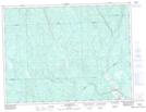
Maps showing Rivière aux Perles, Rivière-Mistassini; Maria-Chapdelaine, Quebec
Rivière aux Perles is a River located in Rivière-Mistassini; Maria-Chapdelaine, Quebec.
- Latitude: 49° 7' 4'' North (decimal: 49.1177778)
- Longitude: 72° 45' 31'' West (decimal: -72.7586111)
- Topography Feature Category: River
- Geographical Feature: Rivière
- Canadian Province/Territory: Quebec
- Location: Rivière-Mistassini; Maria-Chapdelaine
- GPS Coordinate Locator Map: Rivière aux Perles Lat/Long
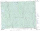
Rivière aux Perles NTS Map Sheets