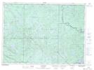
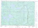
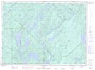
Maps showing Ruisseau Pesashiawa, Lac-Marguerite; Antoine-Labelle, Quebec
Ruisseau Pesashiawa is a River located in Lac-Marguerite; Antoine-Labelle, Quebec.
- Latitude: 46° 55' 15'' North (decimal: 46.9208945)
- Longitude: 76° 7' 3'' West (decimal: -76.1174439)
- Topography Feature Category: River
- Geographical Feature: Ruisseau
- Canadian Province/Territory: Quebec
- Location: Lac-Marguerite; Antoine-Labelle
- GPS Coordinate Locator Map: Ruisseau Pesashiawa Lat/Long
Ruisseau Pesashiawa NTS Map Sheets
031K16 Lac Kellog Topographic Map at 1:50,000 scale
031N01 Lac De L'Ecorce Topographic Map at 1:50,000 scale
031O04 Lac Petawaga Topographic Map at 1:50,000 scale
031K Deep River Topographic Map at 1:250,000 scale
031N Grand-Lac-Victoria Topographic Map at 1:250,000 scale
031O Lac Kempt Topographic Map at 1:250,000 scale
031N01 Lac De L'Ecorce Topographic Map at 1:50,000 scale
031O04 Lac Petawaga Topographic Map at 1:50,000 scale
031K Deep River Topographic Map at 1:250,000 scale
031N Grand-Lac-Victoria Topographic Map at 1:250,000 scale
031O Lac Kempt Topographic Map at 1:250,000 scale