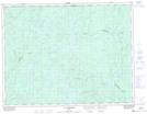
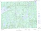
Maps showing Rivière de la Petite Meule, Rivière-Mistassini; Maria-Chapdelaine, Quebec
Rivière de la Petite Meule is a River located in Rivière-Mistassini; Maria-Chapdelaine, Quebec and has an elevation of 383 meters.
- Latitude: 49° 54' 48'' North (decimal: 49.9133995)
- Longitude: 73° 33' 54'' West (decimal: -73.5651293)
- Topography Feature Category: River
- Geographical Feature: Rivière
- Canadian Province/Territory: Quebec
- Elevation: 383 meters
- Location: Rivière-Mistassini; Maria-Chapdelaine
- Atlas of Canada Locator Map: Rivière de la Petite Meule
- GPS Coordinate Locator Map: Rivière de la Petite Meule Lat/Long
Rivière de la Petite Meule NTS Map Sheets