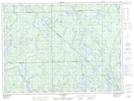
Maps showing Rivière Petit Rocher Nord, La Tuque; Le Haut-Saint-Maurice, Quebec
Rivière Petit Rocher Nord is a River located in La Tuque; Le Haut-Saint-Maurice, Quebec.
- Latitude: 48° 21' 23'' North (decimal: 48.3564490)
- Longitude: 73° 51' 57'' West (decimal: -73.8659496)
- Topography Feature Category: River
- Geographical Feature: Ruisseau
- Canadian Province/Territory: Quebec
- Location: La Tuque; Le Haut-Saint-Maurice
- GPS Coordinate Locator Map: Rivière Petit Rocher Nord Lat/Long
Rivière Petit Rocher Nord NTS Map Sheets