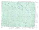
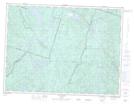
Maps showing Rivière Pika, Lac-Ministuk; Le Fjord-du-Saguenay, Quebec
Rivière Pika is a River located in Lac-Ministuk; Le Fjord-du-Saguenay, Quebec and has an elevation of 587 meters.
- Latitude: 48° 7' 1'' North (decimal: 48.1169872)
- Longitude: 71° 28' 46'' West (decimal: -71.4795459)
- Topography Feature Category: River
- Geographical Feature: Rivière
- Canadian Province/Territory: Quebec
- Elevation: 587 meters
- Location: Lac-Ministuk; Le Fjord-du-Saguenay
- Atlas of Canada Locator Map: Rivière Pika
- GPS Coordinate Locator Map: Rivière Pika Lat/Long
Rivière Pika NTS Map Sheets