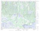
Maps showing Falaise du Pillage, Havre-Saint-Pierre; Minganie, Quebec
Falaise du Pillage is a Cliff located in Havre-Saint-Pierre; Minganie, Quebec and has an elevation of 75 meters.
- Latitude: 50° 16' 20'' North (decimal: 50.2722222)
- Longitude: 63° 12' 33'' West (decimal: -63.2091667)
- Topography Feature Category: Cliff
- Geographical Feature: Falaise
- Canadian Province/Territory: Quebec
- Elevation: 75 meters
- Location: Havre-Saint-Pierre; Minganie
- Atlas of Canada Locator Map: Falaise du Pillage
- GPS Coordinate Locator Map: Falaise du Pillage Lat/Long
Falaise du Pillage NTS Map Sheets