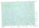
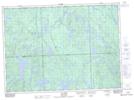
Maps showing Rivière du Pin Blanc, Rivière-Kipawa; Témiscamingue, Quebec
Rivière du Pin Blanc is a River located in Rivière-Kipawa; Témiscamingue, Quebec and has an elevation of 321 meters.
- Latitude: 46° 54' 33'' North (decimal: 46.9092241)
- Longitude: 78° 21' 25'' West (decimal: -78.3569962)
- Topography Feature Category: River
- Geographical Feature: Rivière
- Canadian Province/Territory: Quebec
- Elevation: 321 meters
- Location: Rivière-Kipawa; Témiscamingue
- Atlas of Canada Locator Map: Rivière du Pin Blanc
- GPS Coordinate Locator Map: Rivière du Pin Blanc Lat/Long
Rivière du Pin Blanc NTS Map Sheets