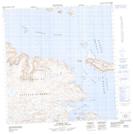
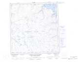
Maps showing Pinnacle Bluff, Rivière-Koksoak; Kativik, Quebec
Pinnacle Bluff is a Cliff located in Rivière-Koksoak; Kativik, Quebec and has an elevation of 33 meters.
- Latitude: 61° 49' 35'' North (decimal: 61.8263382)
- Longitude: 72° 9' 55'' West (decimal: -72.1653725)
- Topography Feature Category: Cliff
- Geographical Feature: Escarpement
- Canadian Province/Territory: Quebec
- Elevation: 33 meters
- Location: Rivière-Koksoak; Kativik
- Atlas of Canada Locator Map: Pinnacle Bluff
- GPS Coordinate Locator Map: Pinnacle Bluff Lat/Long
Pinnacle Bluff NTS Map Sheets