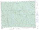
Maps showing Ruisseau du Pluvier, Lac-Ashuapmushuan; Le Domaine-du-Roy, Quebec
Ruisseau du Pluvier is a River located in Lac-Ashuapmushuan; Le Domaine-du-Roy, Quebec and has an elevation of 442 meters.
- Latitude: 48° 46' 26'' North (decimal: 48.7739216)
- Longitude: 73° 2' 31'' West (decimal: -73.0420292)
- Topography Feature Category: River
- Geographical Feature: Ruisseau
- Canadian Province/Territory: Quebec
- Elevation: 442 meters
- Location: Lac-Ashuapmushuan; Le Domaine-du-Roy
- Atlas of Canada Locator Map: Ruisseau du Pluvier
- GPS Coordinate Locator Map: Ruisseau du Pluvier Lat/Long
Ruisseau du Pluvier NTS Map Sheets