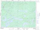
Maps showing Lac de la Pointe de Sable, Baie-James; Jamésie, Quebec
Lac de la Pointe de Sable is a Lake located in Baie-James; Jamésie, Quebec.
- Latitude: 49° 34' 45'' North (decimal: 49.5792432)
- Longitude: 75° 52' 43'' West (decimal: -75.8785365)
- Topography Feature Category: Lake
- Geographical Feature: Lac
- Canadian Province/Territory: Quebec
- Location: Baie-James; Jamésie
- GPS Coordinate Locator Map: Lac de la Pointe de Sable Lat/Long
Lac de la Pointe de Sable NTS Map Sheets