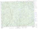
Maps showing Rivière Point Moose, Lac-Ashuapmushuan; Le Domaine-du-Roy, Quebec
Rivière Point Moose is a River located in Lac-Ashuapmushuan; Le Domaine-du-Roy, Quebec.
- Latitude: 48° 5' 41'' North (decimal: 48.0947696)
- Longitude: 72° 41' 43'' West (decimal: -72.6954058)
- Topography Feature Category: River
- Geographical Feature: Ruisseau
- Canadian Province/Territory: Quebec
- Location: Lac-Ashuapmushuan; Le Domaine-du-Roy
- GPS Coordinate Locator Map: Rivière Point Moose Lat/Long
Rivière Point Moose NTS Map Sheets