Maps showing Ruisseau Pouliot, Lac-Walker; Sept-Rivières, Quebec
Ruisseau Pouliot is a River located in Lac-Walker; Sept-Rivières, Quebec.
- Latitude: 49° 36' 16'' North (decimal: 49.6044915)
- Longitude: 67° 41' 43'' West (decimal: -67.6952749)
- Topography Feature Category: River
- Geographical Feature: Rivière
- Canadian Province/Territory: Quebec
- Location: Lac-Walker; Sept-Rivières
- GPS Coordinate Locator Map: Ruisseau Pouliot Lat/Long
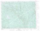
Ruisseau Pouliot NTS Map Sheets