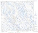
Maps showing Lac Poupeau, Rivière-Koksoak; Kativik, Quebec
Lac Poupeau is a Lake located in Rivière-Koksoak; Kativik, Quebec and has an elevation of 513 meters.
- Latitude: 55° 17' 23'' North (decimal: 55.2898268)
- Longitude: 66° 53' 12'' West (decimal: -66.8867770)
- Topography Feature Category: Lake
- Geographical Feature: Lac
- Canadian Province/Territory: Quebec
- Elevation: 513 meters
- Location: Rivière-Koksoak; Kativik
- Atlas of Canada Locator Map: Lac Poupeau
- GPS Coordinate Locator Map: Lac Poupeau Lat/Long
Lac Poupeau NTS Map Sheets