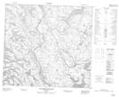
Maps showing Pic Pyramide, Rivière-Koksoak; Kativik, Quebec
Pic Pyramide is a Mountain located in Rivière-Koksoak; Kativik, Quebec.
- Latitude: 57° 29' 58'' North (decimal: 57.4993075)
- Longitude: 65° 17' 11'' West (decimal: -65.2863836)
- Topography Feature Category: Mountain
- Geographical Feature: Sommet
- Canadian Province/Territory: Quebec
- Location: Rivière-Koksoak; Kativik
- Atlas of Canada Locator Map: Pic Pyramide
- GPS Coordinate Locator Map: Pic Pyramide Lat/Long
Pic Pyramide NTS Map Sheets