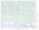
Maps showing Rivière Quetachou, Baie-Johan-Beetz; Minganie, Quebec
Rivière Quetachou is a River located in Baie-Johan-Beetz; Minganie, Quebec and has an elevation of 86 meters.
- Latitude: 50° 18' 37'' North (decimal: 50.3103504)
- Longitude: 62° 43' 23'' West (decimal: -62.7231688)
- Topography Feature Category: River
- Geographical Feature: Rivière
- Canadian Province/Territory: Quebec
- Elevation: 86 meters
- Location: Baie-Johan-Beetz; Minganie
- Atlas of Canada Locator Map: Rivière Quetachou
- GPS Coordinate Locator Map: Rivière Quetachou Lat/Long
Rivière Quetachou NTS Map Sheets