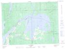
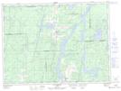
Maps showing Lac des Quinze, Angliers; Témiscamingue, Quebec
Lac des Quinze is a Lake located in Angliers; Témiscamingue, Quebec and has an elevation of 258 meters.
- Latitude: 47° 32' 52'' North (decimal: 47.5477778)
- Longitude: 79° 7' 26'' West (decimal: -79.1238889)
- Topography Feature Category: Lake
- Geographical Feature: Lac
- Canadian Province/Territory: Quebec
- Elevation: 258 meters
- Location: Angliers; Témiscamingue
- Atlas of Canada Locator Map: Lac des Quinze
- GPS Coordinate Locator Map: Lac des Quinze Lat/Long
Lac des Quinze NTS Map Sheets