Maps showing Rapide-des-Cèdres, Lebel-sur-Quévillon; Jamésie, Quebec
Rapide-des-Cèdres is a Unincorporated area located in Lebel-sur-Quévillon; Jamésie, Quebec and has an elevation of 276 meters.
- Latitude: 49° 0' 55'' North (decimal: 49.0152778)
- Longitude: 77° 3' 41'' West (decimal: -77.0613889)
- Topography Feature Category: Unincorporated area
- Geographical Feature: Hameau
- Canadian Province/Territory: Quebec
- Elevation: 276 meters
- Location: Lebel-sur-Quévillon; Jamésie
- Atlas of Canada Locator Map: Rapide-des-Cèdres
- GPS Coordinate Locator Map: Rapide-des-Cèdres Lat/Long
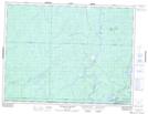
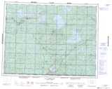
Rapide-des-Cèdres NTS Map Sheets