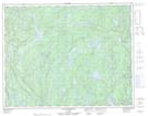
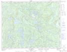
Maps showing Rivière De Raspe, Lac-Jérôme; Minganie, Quebec
Rivière De Raspe is a River located in Lac-Jérôme; Minganie, Quebec and has an elevation of 237 meters.
- Latitude: 50° 52' 23'' North (decimal: 50.8731249)
- Longitude: 62° 26' 12'' West (decimal: -62.4367662)
- Topography Feature Category: River
- Geographical Feature: Rivière
- Canadian Province/Territory: Quebec
- Elevation: 237 meters
- Location: Lac-Jérôme; Minganie
- Atlas of Canada Locator Map: Rivière De Raspe
- GPS Coordinate Locator Map: Rivière De Raspe Lat/Long
Rivière De Raspe NTS Map Sheets