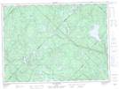
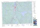
Maps showing Rivière aux Rats, La Tuque; Le Haut-Saint-Maurice, Quebec
Rivière aux Rats is a River located in La Tuque; Le Haut-Saint-Maurice, Quebec and has an elevation of 151 meters.
- Latitude: 47° 13' 12'' North (decimal: 47.2200352)
- Longitude: 72° 53' 24'' West (decimal: -72.8901155)
- Topography Feature Category: River
- Geographical Feature: Rivière
- Canadian Province/Territory: Quebec
- Elevation: 151 meters
- Location: La Tuque; Le Haut-Saint-Maurice
- Atlas of Canada Locator Map: Rivière aux Rats
- GPS Coordinate Locator Map: Rivière aux Rats Lat/Long
Rivière aux Rats NTS Map Sheets