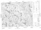
Maps showing Lac De Ré, Petit-Mécatina; Minganie, Quebec
Lac De Ré is a Lake located in Petit-Mécatina; Minganie, Quebec and has an elevation of 291 meters.
- Latitude: 50° 54' 39'' North (decimal: 50.9108945)
- Longitude: 60° 23' 50'' West (decimal: -60.3972530)
- Topography Feature Category: Lake
- Geographical Feature: Lac
- Canadian Province/Territory: Quebec
- Elevation: 291 meters
- Location: Petit-Mécatina; Minganie
- Atlas of Canada Locator Map: Lac De Ré
- GPS Coordinate Locator Map: Lac De Ré Lat/Long