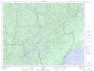
Maps showing Île Red, Ragueneau; Manicouagan, Quebec
Île Red is a Island located in Ragueneau; Manicouagan, Quebec.
- Latitude: 49° 3' 19'' North (decimal: 49.0553211)
- Longitude: 68° 31' 31'' West (decimal: -68.5253156)
- Topography Feature Category: Island
- Geographical Feature: Île / Ile
- Canadian Province/Territory: Quebec
- Location: Ragueneau; Manicouagan
- GPS Coordinate Locator Map: Île Red Lat/Long
Île Red NTS Map Sheets