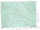
Maps showing Rapides Red Pine, Saint-Alexis-des-Monts; Maskinongé, Quebec
Rapides Red Pine is a Rapids located in Saint-Alexis-des-Monts; Maskinongé, Quebec.
- Latitude: 46° 52' 13'' North (decimal: 46.8703113)
- Longitude: 73° 14' 54'' West (decimal: -73.2484631)
- Topography Feature Category: Rapids
- Geographical Feature: Rapide
- Canadian Province/Territory: Quebec
- Location: Saint-Alexis-des-Monts; Maskinongé
- Atlas of Canada Locator Map: Rapides Red Pine
- GPS Coordinate Locator Map: Rapides Red Pine Lat/Long
Rapides Red Pine NTS Map Sheets