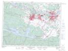
Maps showing Baie à Richard, Saguenay; Saguenay, Quebec
Baie à Richard is a Bay located in Saguenay; Saguenay, Quebec and has an elevation of 173 meters.
- Latitude: 48° 21' 31'' North (decimal: 48.3586111)
- Longitude: 71° 23' 47'' West (decimal: -71.3963889)
- Topography Feature Category: Bay
- Geographical Feature: Baie
- Canadian Province/Territory: Quebec
- Elevation: 173 meters
- Location: Saguenay; Saguenay
- Atlas of Canada Locator Map: Baie à Richard
- GPS Coordinate Locator Map: Baie à Richard Lat/Long
Baie à Richard NTS Map Sheets