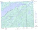
Maps showing Île Richardson, Baie-James; Jamésie, Quebec
Île Richardson is a Island located in Baie-James; Jamésie, Quebec.
- Latitude: 51° 11' 34'' North (decimal: 51.1927778)
- Longitude: 72° 56' 22'' West (decimal: -72.9394444)
- Topography Feature Category: Island
- Geographical Feature: Île / Ile
- Canadian Province/Territory: Quebec
- Location: Baie-James; Jamésie
- Atlas of Canada Locator Map: Île Richardson
- GPS Coordinate Locator Map: Île Richardson Lat/Long
Île Richardson NTS Map Sheets