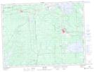
Maps showing Roc-d'Or, Rivière-Héva; Vallée-de-l'Or, Quebec
Roc-d'Or is a Unincorporated area located in Rivière-Héva; Vallée-de-l'Or, Quebec and has an elevation of 316 meters.
- Latitude: 48° 9' 35'' North (decimal: 48.1598138)
- Longitude: 78° 7' 54'' West (decimal: -78.1317118)
- Topography Feature Category: Unincorporated area
- Geographical Feature: Hameau
- Canadian Province/Territory: Quebec
- Elevation: 316 meters
- Location: Rivière-Héva; Vallée-de-l'Or
- Atlas of Canada Locator Map: Roc-d'Or
- GPS Coordinate Locator Map: Roc-d'Or Lat/Long
Roc-d'Or NTS Map Sheets