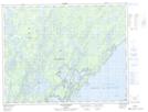
Maps showing Baie de la Roche Rouge, Baie-James; Jamésie, Quebec
Baie de la Roche Rouge is a Bay located in Baie-James; Jamésie, Quebec and has an elevation of 388 meters.
- Latitude: 51° 8' 29'' North (decimal: 51.1413889)
- Longitude: 73° 32' 54'' West (decimal: -73.5483333)
- Topography Feature Category: Bay
- Geographical Feature: Baie
- Canadian Province/Territory: Quebec
- Elevation: 388 meters
- Location: Baie-James; Jamésie
- Atlas of Canada Locator Map: Baie de la Roche Rouge
- GPS Coordinate Locator Map: Baie de la Roche Rouge Lat/Long
Baie de la Roche Rouge NTS Map Sheets