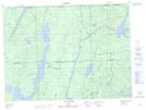
Maps showing Rivière Roger, Rémigny; Témiscamingue, Quebec
Rivière Roger is a River located in Rémigny; Témiscamingue, Quebec and has an elevation of 274 meters.
- Latitude: 47° 51' 14'' North (decimal: 47.8539673)
- Longitude: 78° 43' 2'' West (decimal: -78.7173024)
- Topography Feature Category: River
- Geographical Feature: Rivière
- Canadian Province/Territory: Quebec
- Elevation: 274 meters
- Location: Rémigny; Témiscamingue
- Atlas of Canada Locator Map: Rivière Roger
- GPS Coordinate Locator Map: Rivière Roger Lat/Long
Rivière Roger NTS Map Sheets