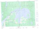
Maps showing Petite rivière Roger, Angliers; Témiscamingue, Quebec
Petite rivière Roger is a River located in Angliers; Témiscamingue, Quebec and has an elevation of 276 meters.
- Latitude: 47° 33' 30'' North (decimal: 47.5584086)
- Longitude: 78° 59' 34'' West (decimal: -78.9928704)
- Topography Feature Category: River
- Geographical Feature: Rivière
- Canadian Province/Territory: Quebec
- Elevation: 276 meters
- Location: Angliers; Témiscamingue
- Atlas of Canada Locator Map: Petite rivière Roger
- GPS Coordinate Locator Map: Petite rivière Roger Lat/Long
Petite rivière Roger NTS Map Sheets