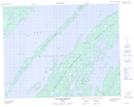
Maps showing Pointe Rolland-Germain, Baie-James; Jamésie, Quebec
Pointe Rolland-Germain is a Cape located in Baie-James; Jamésie, Quebec.
- Latitude: 51° 0' 44'' North (decimal: 51.0122222)
- Longitude: 73° 4' 47'' West (decimal: -73.0797222)
- Topography Feature Category: Cape
- Geographical Feature: Pointe
- Canadian Province/Territory: Quebec
- Location: Baie-James; Jamésie
- Atlas of Canada Locator Map: Pointe Rolland-Germain
- GPS Coordinate Locator Map: Pointe Rolland-Germain Lat/Long
Pointe Rolland-Germain NTS Map Sheets