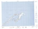
Maps showing Île Rouge, Les Îles-de-la-Madeleine; Les Îles-de-la-Madeleine, Quebec
Île Rouge is a Island located in Les Îles-de-la-Madeleine; Les Îles-de-la-Madeleine, Quebec and has an elevation of 0 meters.
- Latitude: 47° 36' 30'' North (decimal: 47.6084007)
- Longitude: 61° 32' 54'' West (decimal: -61.5484382)
- Topography Feature Category: Island
- Geographical Feature: Île / Ile
- Canadian Province/Territory: Quebec
- Elevation: 0 meters
- Location: Les Îles-de-la-Madeleine; Les Îles-de-la-Madeleine
- Atlas of Canada Locator Map: Île Rouge
- GPS Coordinate Locator Map: Île Rouge Lat/Long
Île Rouge NTS Map Sheets